


Wednesday, May 5th, was a very special day on my adventure. The ever changing surroundings made for an interesting 13 plus mile hike in the western forested area of the beautiful state of Michigan.
Often on this quest, I have thought, that it seemed incongruous that the state of the State of Michigan could be at such odds with itself.
The trail has wound me through agriculture, woods, forests and small towns. The NCT has guided me through local, county, state and national parks and campgrounds. The NCT has clearly been crafted to show off the most positive aspects of the state including the people I have met.
Yet, I am always aware of the economic holocaust and despair that are just beyond my sight. It is a nice respite to be far from news and the doom and gloom of urban Michigan.
Today is special. I left the Alpine resort at 11:00 a.m. and headed past the small downtown area of Croton. An excellent view of the Croton Dam afforded itself and a sign explaining it's purpose was made available for those passing by.
This dam is On the Muskegon River and houses a power plant which generates electricity for this area and most of this part of Michigan including Muskegon.
The trail head was reached a little further down the road. As I left the over the road portion of the NCT I stepped into a pleasant wooded area. I said my good-byes to the picturesque town of Croton and headed into nature.
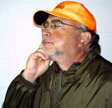
There was a sign-in log station set up at the trail head and the crazy hiker signed in and left his "card". Diane had been kind enough to make 40 cards for me which include my picture and website address.
I felt exhilarated walking the trail through the wooded area. This part of the trail is well maintained and heavily used. It is also very clean. Good job people of the Croton area.
Looking up I saw a lone eagle flying overhead. Not moving it's wings, he road the air currents at what seemed a lazy but ground eating pace. One or two beats of his powerful wings and he quickly passed from my sight. That alone would have made my day complete.
The trail is almost exclusively forested today and I was hurting my neck as I craned eagerly trying to see the tops of some of the old forest trees.
When they had logged this area more than 100 years before they had left singular trees standing. This was not necessarily a common practice as I had not encountered trees of this size before this point.
There were several areas of planted Red Pine which appeared to have been planted in the 30's or 40's. They were more developed than like plantings I have seen in the earlier days of hiking.
At one point I reached an area that was designated a "natural area". I am not sure why I was so surprised that Prickly Pear Cactus were so abundant in this area. I thought they were a desert plant.
My mood continued to be upbeat as I communed with nature and was pushing 10 miles. However, it was time to find this night's lodging. I was looking for a campground that was called "Twin Lakes" on my map.
Reaching Basswood Dr, I turned to the north as the map directed. The road/trail ran next to a railroad track. There are northern Michigan trailers and cabins, spaced just far enough apart that neighbors would not be a problem.
Close to two miles had been covered when I noticed a young couple coming in my direction. I had been following the tracks they had left on their way out for about an half a mile. Now they were on their return trip. I asked them if they knew of the "Twin Lakes" campground. They were not familiar with the name but I was informed that just up on the right there was a boat access ramp and a few campsites.
This information raised my confidence level as I trudged on. I still could find no campground even though the Larger Twin Lake had come and gone from my line of sight.
Now a decision had to be made. The trail cut to the west towards M-37. To my left the trail head and to my right the small road to what I thought was another cabin.
I chose the trail. It seemed likely I would find a sign or at least a store to ask directions when I reached M-37. Quicker than I expected, the highway was reached. Quite a ways to the north I saw a few businesses but I could not tell what they were. I walked north along the highway.
To my pleasure I was greeted by the Manistee Forest welcome sign. Just ahead was the corner of 40th street and M-37. Even though it was 6:00 p.m. a school bus was approaching a church parking lot. I saw a mother waiting in her car for her three children to return to her from the bus.
I hurried over to her car. Without startling her I got her attention. After enquiring about the campground she informed me that it was down the little dirt road just ahead. She told me it would be difficult to find and that she has camped there herself.
Thanking her I headed to the little road that turned out to be Basswood again. It became obvious that the last mile and a half of today's journey would wind up being a large circle.
Down Basswood I went expecting to find the sign for the campground every step of the way. No sign and now I was back at the same entrance to the trail that I had taken 30minutes earlier. The circle was complete.
This time I chose to go left on what I had earlier thought was a driveway to someone's summer retreat.
It turned out to be a small road leading down to the lake. Eight campsites and a boat ramp. The young couple had been accurate.
What is an extra mile and a half after packing twelve miles? A heck of a lot. But here I was at last and I was not disappointed.
The campground is a primitive National Park Campground. I would be the only one staying the night. I put up my tent and fished for about an hour until almost dark. Once again, no fish.
I slept well and a very rewarding day was received for my efforts.
No comments:
Post a Comment